Stages of the French Way
Complete Guide to the Camino Francés
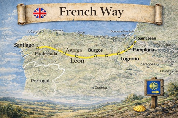
The Camino Francés is the most historic, traditional and emblematic route of the Camino de Santiago. For centuries it has been the main pilgrimage itinerary to Santiago de Compostela, used by millions of pilgrims from all over Europe. This route crosses the north of the Iberian Peninsula from east to west, passing through France, Navarre, La Rioja, Castile and León and Galicia, connecting villages, cities, landscapes and monuments that form part of Europe's cultural and historical heritage. The Camino Francés is the most complete route of the Camino de Santiago: it combines history, spirituality, culture, landscape diversity, service infrastructure and pilgrim tradition like no other Jacobean itinerary.
Map of the Camino Francés
Interactive map and offline guide
Peregrino Online has complete maps of the Camino Francés with all stages, hostels, services and points of interest. The maps are available both on the web and in the Android and iPhone app, with the option to download them and use them offline during the journey.
- Maps on Google Maps, with all the information it provides.
- Location of all hostels and hotels
- Special points of interest
- Detours and alternative routes marked
- Periodic updates to the route
Download the Peregrino Online app before you leave. The offline map lets you navigate without using data and without depending on coverage in the rural sections of the Camino Francés.
Where does the Camino Francés start?
Traditional starting point of the Camino Francés
- Main starting point: Saint-Jean-Pied-de-Port (France)
- Spanish alternative: Roncesvalles (Navarre)
- Total approximate distance: 780 km
- Number of stages: 30–35 stages (depending on planning)
- Right to Compostela: Yes
- Type of route: mountain, rural, urban and meseta
- Profile: ideal for those seeking the complete Jacobean experience
Camino Francés from Roncesvalles
Roncesvalles is the first Spanish town on the Camino Francés and the most popular alternative starting point for those who do not want or cannot do the Pyrenees crossing from Saint-Jean-Pied-de-Port. Many pilgrims who arrive by plane or train choose to start here directly, which takes nothing away from the experience or the right to obtain the Compostela.
How many kilometres from Roncesvalles to Santiago?
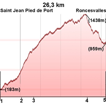
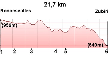
From Roncesvalles to Santiago de Compostela there are approximately 753 kilometres, spread across 31 stages (from stage 2 to stage 32 of the standard plan). The first stage from Roncesvalles is Roncesvalles–Zubiri (21.7 km), a route through the Arga river valley through beech forests.
How to get to Roncesvalles to start the Camino Francés?
- From Pamplona by bus: there is a regular service by La Montañesa, with daily departures. The journey takes approximately 1 hour.
- From Pamplona by taxi: the most flexible option, especially useful with heavy luggage or at irregular times.
- From Pamplona airport: Noáin airport has connections to Madrid and Barcelona. From there, take a taxi or bus to Pamplona and then connect to Roncesvalles.
- From Bilbao airport: bus or train connection to Pamplona and from there to Roncesvalles.
Differences between starting in Saint-Jean and in Roncesvalles
| From Saint-Jean-Pied-de-Port | From Roncesvalles | |
|---|---|---|
| Total distance | ~780 km | ~753 km |
| No. of stages | 32 | 31 |
| Pyrenees crossing | Yes (stage 1, demanding) | No |
| Right to Compostela | Yes | Yes |
| Accessibility | Requires travelling to France | Easy from Pamplona |
| Experience | Complete, entering from France | Complete from Spain |
Starting in Roncesvalles is just as valid as starting from Saint-Jean. The only real difference is that you miss the Pyrenees crossing, one of the most spectacular but also most demanding stages of the Camino.
Stages of the French Way
The French Way has an approximate length of 780 km and is usually structured into 32 stages from Saint-Jean-Pied-de-Port to Santiago de Compostela, making it the most emblematic, historic, and most traveled route of the Camino de Santiago.
This organization into 32 stages corresponds to the classical model of the French Way and allows progressive, balanced planning adapted to all types of pilgrims, from first-time walkers to experienced pilgrims.
The French Way has an approximate length of 780 km from Saint-Jean-Pied-de-Port and is usually structured into between 30 and 35 stages, depending on the pilgrim’s pace, planning, and route organization.
How many kilometres is the Camino Francés?
The Camino Francés is 780 kilometres from Saint-Jean-Pied-de-Port to Santiago de Compostela. It is the longest Jacobean route commonly walked and also the most complete in terms of landscape variety, historical heritage and stage diversity.
If Roncesvalles is taken as the starting point, the total distance is approximately 753 kilometres, skipping the Pyrenees crossing from France. In both cases, the Camino Francés far exceeds the minimum 100 km required to obtain the Compostela.
| Starting point | Distance to Santiago | Estimated days |
|---|---|---|
| Saint-Jean-Pied-de-Port | ~780 km | 30–35 days |
| Roncesvalles | ~753 km | 29–33 days |
| Pamplona | ~680 km | 26–30 days |
| Burgos | ~490 km | 19–22 days |
| León | ~310 km | 12–14 days |
| Sarria | ~115 km | 5–6 days |
The official distance to obtain the Compostela is 100 km on foot or 200 km by bicycle. Sarria is the closest minimum starting point most commonly used on the Camino Francés.
How many stages does the Camino Francés have?
The Camino Francés is usually divided into 32 stages from Saint-Jean-Pied-de-Port to Santiago de Compostela. However, the exact number of stages depends on each pilgrim's planning: some walkers split long stages and complete the route in 35 or even 38 days, while others with a faster pace finish in 28 or 30 days.
The 32-stage plan is the most common and balanced, with an average of approximately 24 km per stage. This structure allows physical effort to be built up progressively and ensures a complete experience of the route.
| Pace | No. of stages | Average per stage |
|---|---|---|
| Comfortable pace (recommended) | 32–35 stages | 22–24 km/day |
| Standard pace | 30–32 stages | 24–26 km/day |
| Demanding pace | 28–30 stages | 26–28 km/day |
| Last 100 km only (from Sarria) | 5–6 stages | 19–23 km/day |
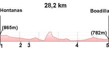
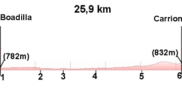
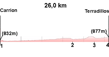
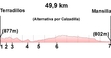
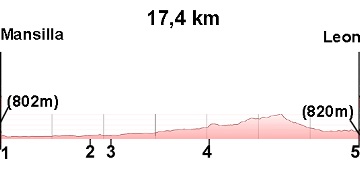
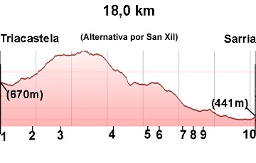
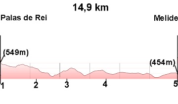
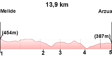
The longest stage in the standard plan is stage 17 (Terradillos – Mansilla de las Mulas, almost 50 km), which many pilgrims split into two days. The shortest is stage 29 (Palas de Rei – Melide, 14.9 km), ideal for resting before the final stretch.
If this is your first Camino, plan for 32–35 stages. It is better to arrive in Santiago rested than to push too hard and risk injury in the first few weeks.
Frequently asked questions about the Camino Francés
How many kilometres is the Camino Francés?
The Camino Francés is approximately 780 kilometres from Saint-Jean-Pied-de-Port to Santiago de Compostela.
How many days does the Camino Francés take?
The usual duration is 30 to 35 days, depending on the pilgrim's pace and stage planning.
Where does the Camino Francés start?
The traditional starting point is Saint-Jean-Pied-de-Port (France), crossing the Pyrenees to Roncesvalles. It is also common to start directly in Roncesvalles.
Is the Camino Francés difficult?
The Camino Francés has variable difficulty. It includes demanding sections such as the Pyrenees crossing and the Montes de León, but also long flat stages across the meseta. It is physically and mentally challenging, but accessible with proper preparation.
What is the best time of year to do the Camino Francés?
The best times are spring and autumn. Summer is very popular but also the most crowded period, especially in July and August.
Can you get the Compostela on the Camino Francés?
Yes. The Camino Francés far exceeds the minimum 100 km required to obtain the Compostela upon arriving in Santiago de Compostela.
How many kilometres is it from Sarria to Santiago de Compostela?
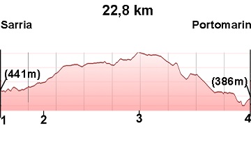
The official distance from Sarria to Santiago de Compostela along the Camino Francés is approximately 115 kilometres. This is the minimum distance recognised by the Pilgrim's Office to obtain the Compostela on foot. The route is divided into 6 stages and is usually completed in 5 or 6 days.
What is the hardest stage of the Camino Francés?
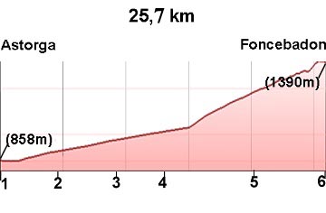
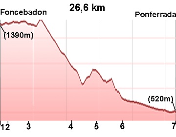
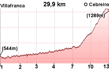
The most demanding stage of the Camino Francés is the first: Saint-Jean-Pied-de-Port – Roncesvalles (26.3 km), with a positive elevation gain of more than 1,200 metres crossing the Pyrenees. Other particularly tough stages are Astorga – Foncebadón (climb to the Cruz de Ferro) and Villafranca del Bierzo – O Cebreiro (steep ascent). In general, the meseta stages (Burgos – León) are long and monotonous but without technical difficulty.
Can you do the Camino Francés in winter?
Yes, although with some considerations. The Camino Francés can be walked year-round, but in winter the Pyrenees crossing may be closed due to snow (usually from November to March). During those months, the obligatory alternative is to start from Roncesvalles or use the Valcarlos route. January and February are the quietest months of the year, with very few pilgrims and many hostels closed. It is recommended to book accommodation in advance and bring gear suitable for cold and rain.
How much does the Camino Francés cost?
The average budget for the Camino Francés is between 30 and 50 euros per day, depending on the type of accommodation and food chosen. Staying in public hostels (between 8 and 15 euros per night) is the most economical option. Pilgrims who prefer private hostels or guesthouses may spend between 20 and 40 euros on accommodation alone. To this must be added meals, transport to the starting point and equipment.
What credential do I need for the Camino Francés?
To walk the Camino Francés and obtain the Compostela you need the Pilgrim's Credential (Credencial del Peregrino), an official document stamped at hostels, churches, bars and other points along the route. You can obtain it before leaving from the Friends of the Camino de Santiago associations in your city, at the Camino offices in Saint-Jean-Pied-de-Port or Roncesvalles, or at many hostels along the way. There are also ways to process it online before you set off.
Is the Camino Francés well signposted?
Yes. The Camino Francés is the best signposted route of the entire Camino de Santiago. Yellow arrows and scallop shells mark the route at every point along the way. Although in some urban areas the signs may be less visible, in practice it is virtually impossible to get lost if you pay attention. The Peregrino Online app complements the physical signposting with up-to-date GPS maps for each stage.
Can you do the Camino Francés by bike?
Yes. The Camino Francés is suitable for cycling along most of its route, although some sections with mud or loose stone can be difficult with a road bike. To obtain the Compostela by bicycle, the minimum is 200 km (instead of 100 km on foot), so the closest starting point would be Ponferrada or Astorga. The Peregrino Online app includes the Bicigrino guide, specifically designed for cycling pilgrims.
Do you have more questions about the Camino Francés? Write to us at elperegrino.online@gmail.com or download the app to access all updated information.
Historical importance of the Camino Francés
The Camino Francés has been the central axis of the Jacobean pilgrimage since the Middle Ages. It has been the main channel of cultural, religious, economic and social exchange between Europe and the Iberian Peninsula. Cities such as Pamplona, Logroño, Burgos, León, Astorga and Santiago de Compostela grew and developed thanks to the continuous flow of pilgrims over the centuries.
Statistics of the Camino Francés
The Camino Francés is by far the most travelled route of the entire Camino de Santiago. In 2025, approximately 45% of all pilgrims chose this route, meaning around 240,000 pilgrims walked all or part of the Camino Francés. In terms of origin, 52% were Spanish pilgrims, while the remaining 48% were international. The most numerous foreign nationalities were, in order: Americans, Italians, Mexicans, Irish, Koreans, French, British and Germans, confirming the deeply international character of the Camino Francés.
Growth of the Camino Francés
The Camino Francés has experienced sustained growth in recent years. Taking 2019 as a reference, when approximately 190,000 pilgrims completed this route, in just six years the figure has reached 240,000 pilgrims annually. This growth is directly related to the global increase in interest in the Camino de Santiago and the consolidation of the Camino Francés as the main and best-known route of the Jacobean network.
Most common starting points
One of the most relevant statistics is that 67% of pilgrims on the Camino Francés begin their journey in Sarria, a town located just over 100 km from Santiago, the minimum distance required to obtain the Compostela. This concentration causes significant congestion in the last 100 kilometres of the route. As an alternative to this crowding, many pilgrims choose routes such as the Camino Sanabrés or the Camino de Invierno, less-travelled itineraries that also allow you to obtain the Compostela and offer a quieter, more authentic experience, and for which we also have a complete guide. In addition to Sarria, other popular starting points on the Camino Francés are:
- Saint-Jean-Pied-de-Port: ~30,000 pilgrims
- León: ~7,000 pilgrims
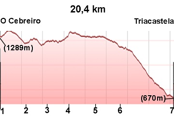
- O Cebreiro: ~6,000 pilgrims
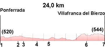
- Ponferrada: ~5,000 pilgrims
- Roncesvalles: ~4,000 pilgrims
- Astorga: ~3,000 pilgrims
Added to these are dozens of intermediate towns from which pilgrims begin the Camino Francés, demonstrating the enormous flexibility of the route.
Months with the highest number of pilgrims
The busiest months on the Camino Francés are May, June, August and September, with an average of approximately 35,000 pilgrims per month. During April, July and October, figures are also high, with between 25,000 and 30,000 pilgrims per month. In the winter months, numbers drop significantly due to weather conditions and reduced services.
Ways to complete the Camino Francés
The vast majority of pilgrims walk the Camino Francés on foot. However, around 4% do it by bicycle. As notable figures, approximately 300 people completed it on horseback and just over 100 pilgrims finished the route in a wheelchair, demonstrating the diversity of profiles that walk this route.
Gender distribution
In 2025, the pilgrim profile was made up of 53% women and 47% men, confirming a balanced participation and a growing female presence in the Jacobean pilgrimage.
Planning the Camino Francés
How many days do you need?
Between 30 and 35 days from Saint-Jean-Pied-de-Port.
Best time to go
Spring and autumn are the most recommended times. Summer has good weather but high crowds.
Difficulty level
Medium-high difficulty due to accumulated distance, though technically accessible.
Infrastructure
- Extensive network of public and private hostels
- Historic and modern signposting
- Medical services
- Restaurants and bars
- Transport
Pilgrim preparation
- Prior physical training
- Proper trekking footwear
- Light backpack
- Technical clothing
- Weather protection
- Pilgrim's Credential
The Camino Francés is not technically complex, but it does require good physical preparation due to its length and continuity.
Who is the Camino Francés ideal for?
- Pilgrims seeking the complete Camino de Santiago experience
- People with time available
- History and culture lovers
- Spiritual pilgrims
- Long-distance travellers
- People who want to live the classic Jacobean tradition
Advantages of the Camino Francés
- Main historic route
- Greatest service infrastructure
- Living pilgrim tradition
- Landscape diversity
- Cultural and monumental heritage
- Large pilgrim community
- Safety and signposting
The Camino Francés within the Camino de Santiago
The Camino Francés is the central axis of the Jacobean network. All other routes converge directly or indirectly on it, making it the backbone of the Camino de Santiago. It represents the most traditional, historic and complete way to experience the pilgrimage to Santiago de Compostela.
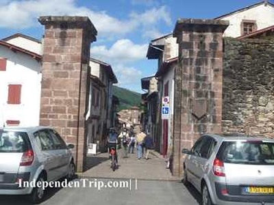
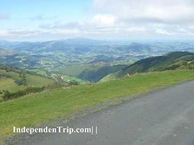
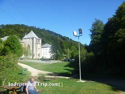
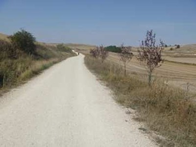
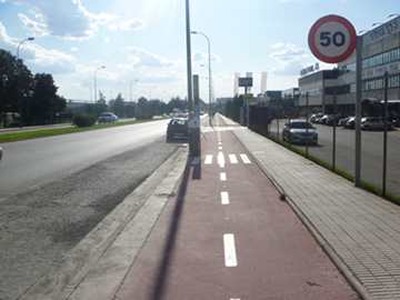
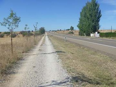
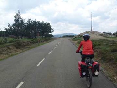
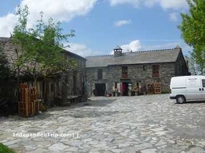
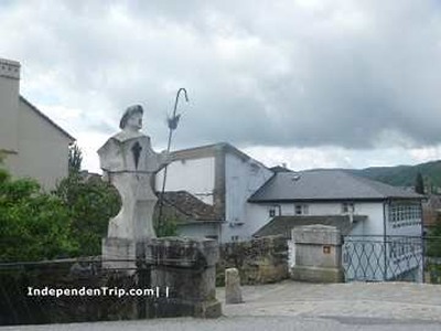
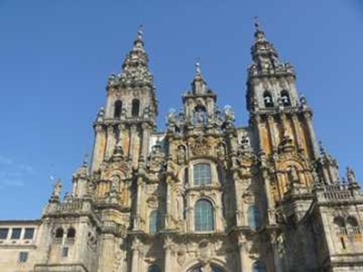
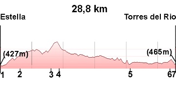
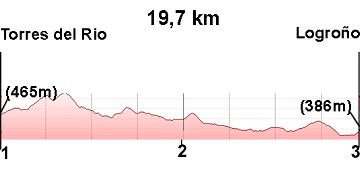
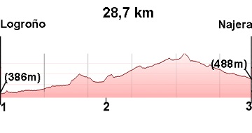
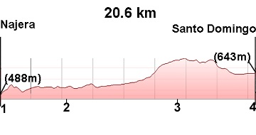
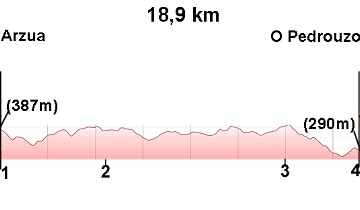
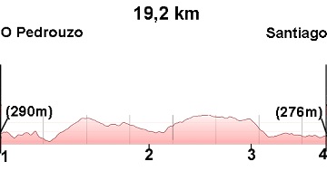
The Camino Francés in images