Via de la Plata Stages
Complete Guide to the Via de la Plata Camino – Stages, Distances and Planning
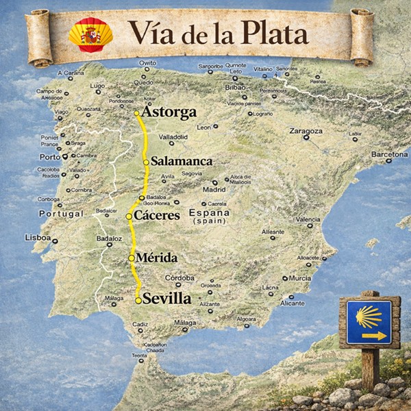
The Via de la Plata is the longest, most historical and most monumental route of the Camino de Santiago. It is a millennia-old itinerary that largely follows the ancient Roman road Ab Emerita Asturicam, used since Roman times to connect the south and north of the Iberian Peninsula. This Jacobean route crosses the peninsula from south to north, passing through Andalusia, Extremadura, Castile and León, and Galicia, and connecting some of the country's most important historical cities.
The Via de la Plata is the most extensive, cultural, heritage-rich and solitary route of the Jacobean system, combining history, archaeology, spirituality, nature, wide open spaces and a deeply authentic pilgrimage experience.
What is the Via de la Plata? History and Roman Origins
The name Via de la Plata does not refer to silver (plata in Spanish), but derives from the Latin Iter ab Emerita Asturicam, the Roman road connecting Mérida (Emerita Augusta) with Astorga (Asturica Augusta). Built between the 1st and 2nd centuries AD, it was for centuries the main vertebral axis of the western Iberian Peninsula.
This Roman infrastructure was reused in the Middle Ages as a Jacobean pilgrimage route, becoming one of the oldest Camino de Santiago routes. Unlike other caminos that were born as pilgrimage routes, the Via de la Plata is first and foremost a Roman road that was adopted by pilgrims. Its original layout is preserved in numerous sections, including milestones, Roman bridges and mansions that pilgrims can visit along the way.
Cities such as Italica, Mérida, Cáceres, Salamanca, Zamora and Astorga form one of the most important historical axes in the history of the peninsula, making the Via de la Plata an archaeological and historical journey without equal within the Jacobean system.
Via de la Plata Route Map
Interactive map and offline guide
Peregrino Online provides complete maps of the Via de la Plata with all stages, hostels (pilgrim hostels), services and points of interest. The maps are available both on the website and in the Android and iPhone app, with offline download capability for use during the walk.
- Google Maps with all available information
- Location of all hostels and hotels
- Archaeological and historical points of interest
- Marked sections of the original Roman road
- Regular route updates
Download the Peregrino Online app before you set off. The offline map lets you navigate without mobile data and without depending on coverage in the rural sections of the Via de la Plata.
Where Does the Via de la Plata Start?
Traditional starting point of the Via de la Plata
- Main start: Seville (Andalusia)
- Common alternatives: Mérida, Cáceres, Salamanca
- Total distance (approximate): ~1,000 km from Seville
- Number of stages: 33 stages to Astorga (plus the Camino Francés or Sanabrés stages)
- Compostela eligibility: Yes
- Terrain: urban areas, dehesa (oak savannah), plains, mountain, rural zones
- Profile: experienced pilgrims, lovers of solitude and history
| Starting point | Distance to Santiago | Estimated days |
|---|---|---|
| Seville | ~1,000 km | 38–45 days |
| Mérida | ~770 km | 30–35 days |
| Cáceres | ~620 km | 24–28 days |
| Salamanca | ~380 km | 15–18 days |
| Zamora | ~290 km | 11–14 days |
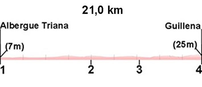
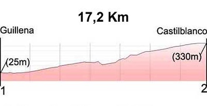
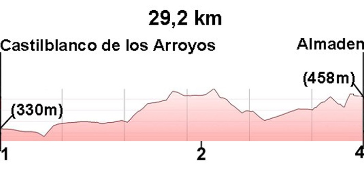
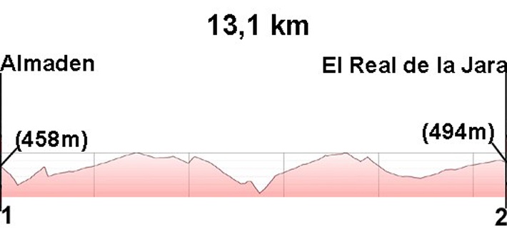
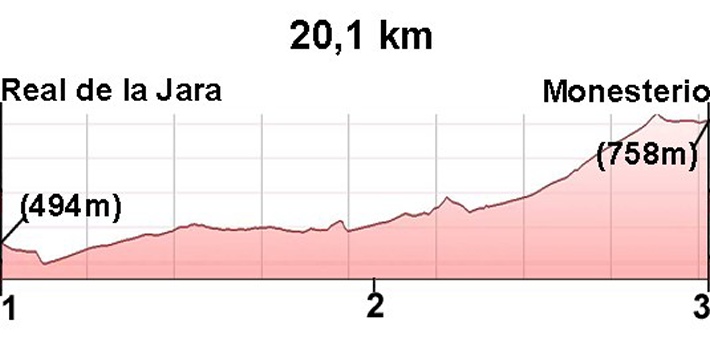
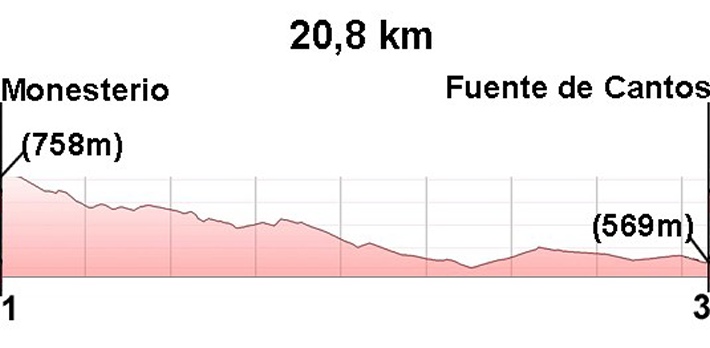
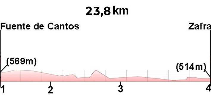
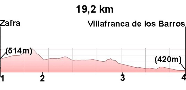
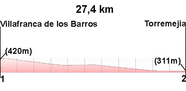
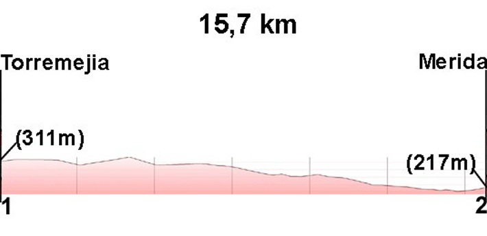
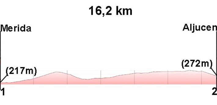
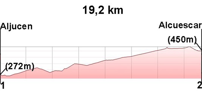
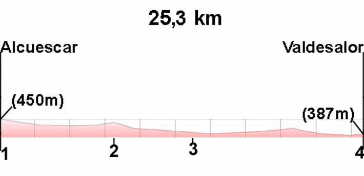
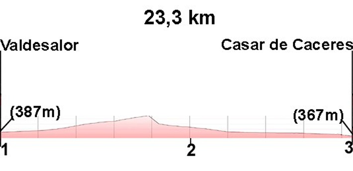
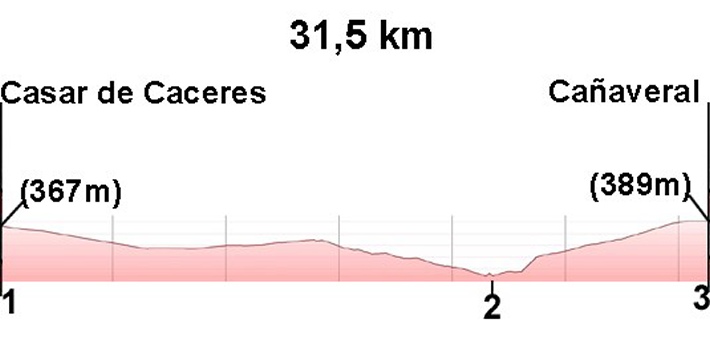
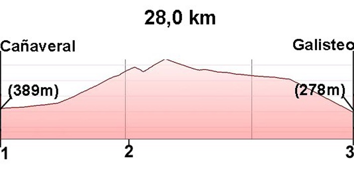
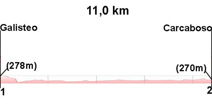
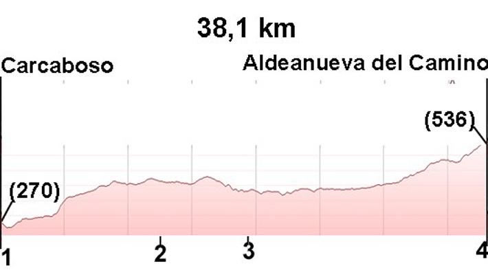
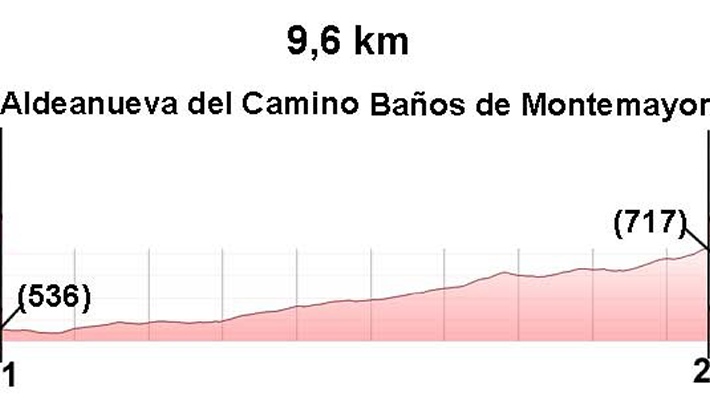
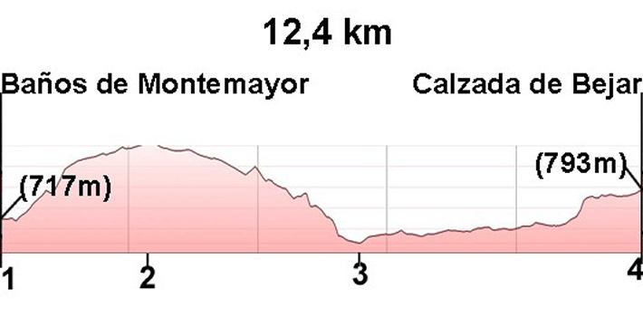
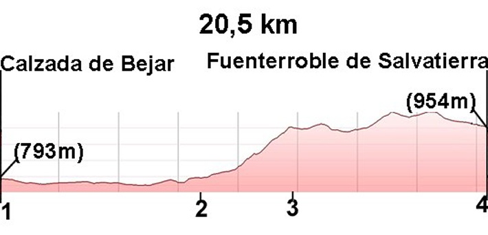
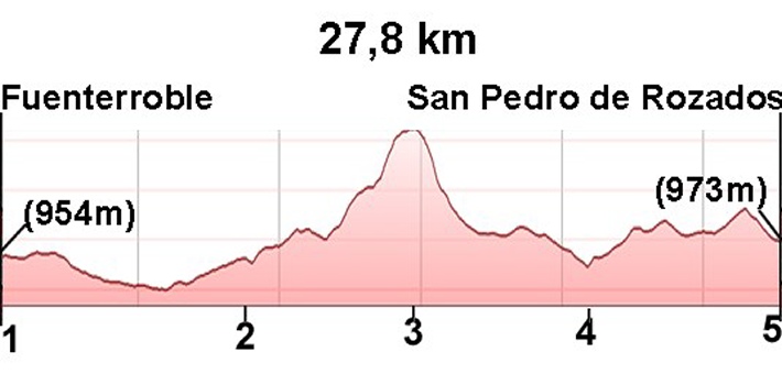
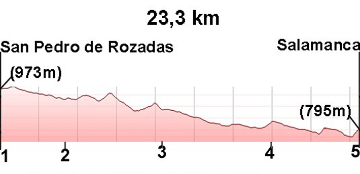
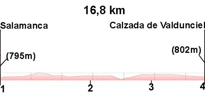
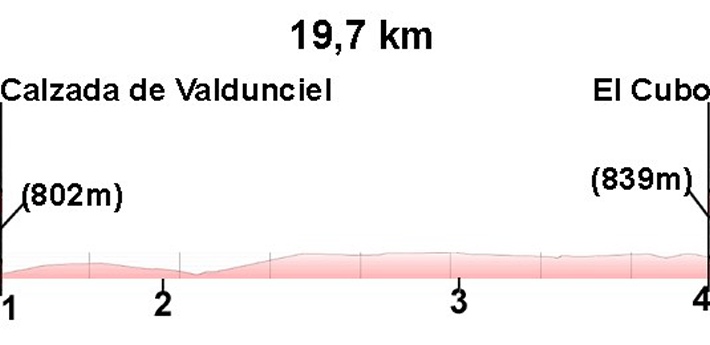
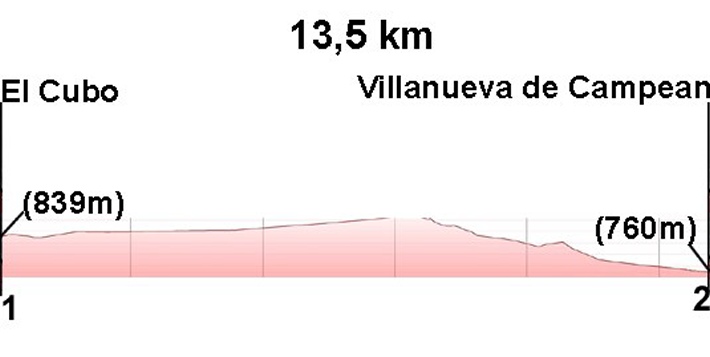
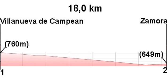
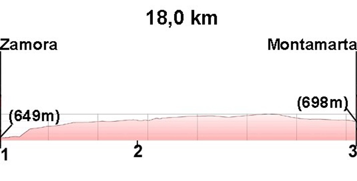
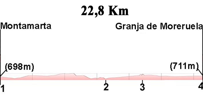
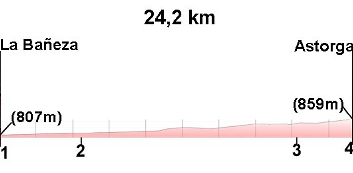
Via de la Plata Stages
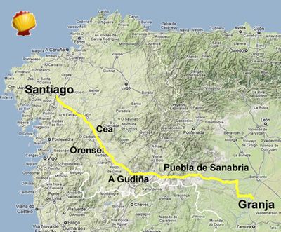
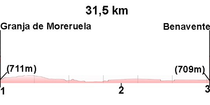
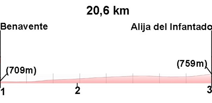
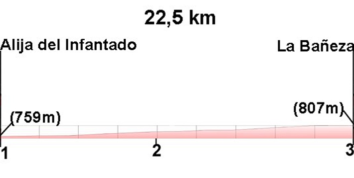
The Via de la Plata covers approximately 677 km from Seville to Astorga, divided into 33 stages. From Astorga, pilgrims can continue along the Camino Francés to Santiago, or branch off earlier at Granja de Moreruela via the Camino Sanabrés, the most direct route through Galicia to Santiago.
This double fork makes the Via de la Plata one of the most versatile routes in the Jacobean system, allowing multiple combinations depending on available time and the experience sought.
Total distance Seville – Astorga: 677.4 km
How Many Kilometres is the Via de la Plata?
The Via de la Plata covers approximately 677 km from Seville to Astorga, which is the route's own stretch. From Astorga, pilgrims can link up with the Camino Francés (around 270 km more) to reach Santiago, or take the Camino Sanabrés from Granja de Moreruela, adding approximately 290 km directly to Santiago. In total, the complete journey from Seville to Santiago de Compostela is around 1,000 km, making the Via de la Plata the longest route in the entire Jacobean system.
Via de la Plata by Bicycle
The Via de la Plata is considered one of the best Camino de Santiago routes for cycling. Its wide, well-consolidated track, sparse traffic, vast open landscapes and relatively flat terrain make it the ideal route for cycle pilgrims. Approximately 12% of pilgrims who walk the Via de la Plata do so by bicycle — the highest percentage of any Jacobean route.
To receive the Compostela by bicycle, the minimum distance is 200 km, so any starting point on the Via de la Plata comfortably meets this requirement. The Peregrino Online app includes the Bicigrino guide with specific information for cyclists on the layout, services and alternatives of the Via de la Plata.
Best Time to Walk the Via de la Plata
Spring (March–May) and autumn (September–October) are the best times to walk the Via de la Plata. Summer is particularly demanding in Andalusia and Extremadura, where temperatures can exceed 40°C (104°F). Most pilgrims starting in Seville choose April or May, while those starting from Galicia tend to prefer June or July.
Frequently Asked Questions about the Via de la Plata
How many kilometres is the Via de la Plata?
From Seville to Astorga, the Via de la Plata is 677 km in 33 stages. The complete route to Santiago de Compostela, adding the final stretch (Camino Francés or Sanabrés), is approximately 1,000 km.
How many days does it take to walk the Via de la Plata?
Between 38 and 45 days for the full route from Seville, depending on pace, planning and chosen variant.
Where does the Via de la Plata start?
The traditional starting point is Seville, at the Church of San Jacinto. It is also possible to begin in Mérida, Cáceres or Salamanca for shorter routes.
Is the Via de la Plata difficult?
Yes. It is considered one of the most demanding Camino de Santiago routes due to its length, extreme heat in summer, limited services in some sections and greater solitude compared to other routes.
Does the Via de la Plata qualify for the Compostela?
Yes. The Via de la Plata far exceeds the minimum 100 km required for the Compostela on foot, or 200 km by bicycle.
What is the difference between the Via de la Plata and the Camino Sanabrés?
The Via de la Plata follows the historic Roman road from Seville to Astorga, where it joins the Camino Francés. The Camino Sanabrés branches off from Granja de Moreruela heading into Galicia through Zamora, Ourense and the Ribeira Sacra. On Peregrino Online we treat both as independent routes, although the statistical data we publish includes pilgrims from both variants.
Can you do the Via de la Plata by bicycle?
Yes, and it is one of the best options. Around 12% of pilgrims complete it by bike. The trail is very well suited to cycling, with wide tracks and little traffic. The Peregrino Online app includes the Bicigrino guide specific to this route.
Are there hostels along the whole Via de la Plata?
The hostel network exists but is more limited than on the Camino Francés or Camino Portugués. In some sections services are very spread out, which requires careful advance planning, especially through Extremadura.
How does the Via de la Plata compare to the Camino Francés?
The Camino Francés (800 km from Saint-Jean-Pied-de-Port) is the most popular route with the best infrastructure and the most crowded hostels. The Via de la Plata is longer (~1,000 km from Seville), much less crowded, more demanding logistically, and offers an incomparably richer Roman and medieval heritage experience. It is a route for pilgrims seeking depth and authenticity over comfort and camaraderie.
Via de la Plata Statistics
On Peregrino Online we have structured the itinerary as two distinct routes: the Via de la Plata and the Camino Sanabrés. Both routes diverge at Granja de Moreruela, where pilgrims can choose between continuing to Astorga to link with the Camino Francés, or taking the Camino Sanabrés variant towards Galicia.
The statistical data presented below corresponds to the combined total of the Via de la Plata and the Camino Sanabrés.
Pilgrimage data
In 2025, approximately 9,000 pilgrims completed all or part of the Via de la Plata. The main starting points were:
- Ourense: approximately 4,500 pilgrims
- Seville: approximately 1,800 pilgrims
At greater distances, with fewer than 300 pilgrims per year per town, other starting points include Salamanca, Zamora and Granja de Moreruela, confirming the decentralised and flexible nature of this itinerary.
Trends and crowd levels
The Via de la Plata has maintained a stable average of approximately 9,000 pilgrims per year, reflecting a consistent flow without overcrowding peaks. Unlike the Camino Francés or the Camino Portugués, the Via de la Plata has no saturation issues, making it an ideal choice for pilgrims seeking a more peaceful, authentic and solitary experience.
Busiest months
The busiest month is May, followed by June and July. Climate is a key factor:
- Pilgrims starting in Seville typically choose April, May, September or October, avoiding extreme summer heat.
- Those starting in Galicia tend to prefer June and July, taking advantage of the milder northern climate.
Pilgrim profile
56% of Via de la Plata pilgrims are Spanish nationals. Among international pilgrims, the most represented nationalities are:
- Portugal
- Italy
- Germany
- United States
- United Kingdom
- France
How pilgrims travel the Via de la Plata
The vast majority walk the Via de la Plata on foot, although approximately 12% choose to complete it by bicycle — the highest percentage of any Jacobean route. With nearly 1,000 km from Seville, it represents a significant physical challenge for walkers, but its continuous layout, progressive profile and low crowds make it one of the best Camino de Santiago routes for cycling.
Planning the Via de la Plata
Days required
Between 38 and 45 days from Seville to Santiago.
Best time of year
Spring (March–May) and autumn (September–October).
Difficulty
High, due to distance, extreme heat in the south and limited service infrastructure.
Infrastructure
- Limited hostel network, more spread out than on other routes
- Scarce services in some rural sections
- Variable waymarking, better in the north
- High self-sufficiency required, especially through Extremadura
Pilgrim Preparation
- Strong prior physical preparation
- Detailed logistical planning of hostels and services
- Water management: fountains can be very spread out in some sections
- Strong sun protection, especially in summer
- Technical gear appropriate for the heat
- Navigation skills for poorly waymarked sections
Who is the Via de la Plata Ideal For?
- Experienced pilgrims who have completed previous caminos
- Those seeking solitude, silence and wide open spaces
- Lovers of ancient history and Roman archaeology
- Spiritual pilgrims seeking a deep, transformative experience
- Cycle pilgrims looking for the best Jacobean cycling route
- People seeking authenticity, away from crowds
Advantages of the Via de la Plata
- The longest and most historical Camino de Santiago route
- The only route that follows an original Roman road
- Deeply spiritual and authentic experience
- Low crowds — no queues at hostels or bottlenecks
- Unparalleled Roman and medieval heritage: Mérida, Cáceres, Salamanca, Zamora
- Wild nature: Extremaduran dehesa, Castilian plains
- The best Camino de Santiago route for cyclists
The Via de la Plata within the Camino de Santiago
The Via de la Plata is the south-north axis of the Jacobean system. It represents the most ancestral, demanding and authentic Camino de Santiago route, considered by many pilgrims to be the purest form of the Jacobean pilgrimage experience. Its connection with the Camino Sanabrés from Granja de Moreruela also makes it an itinerary with multiple finishing options, adaptable to different pilgrim profiles and available time.
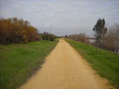
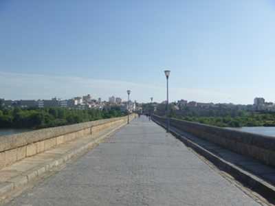
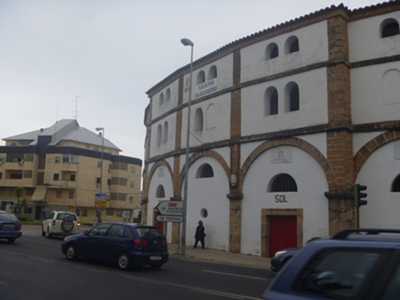
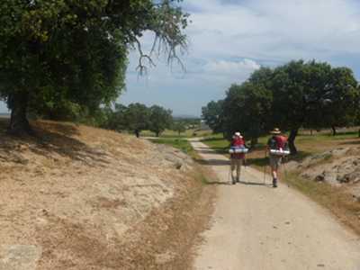
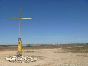
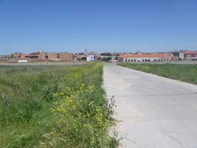
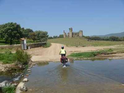
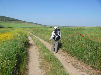
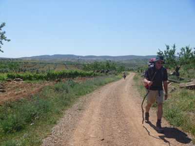
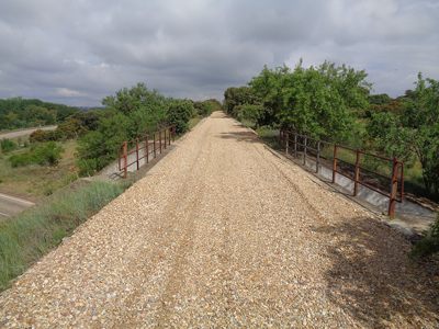
Via de la Plata in Images